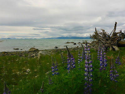
Sunday, July 8, 2018

Outer South Baranof: July 8, Aspid Cape to Sandy Bay

Slow morning--got a late start, and shortly after launching, ran into another paddler (in a plastic sit-on-top recreational kayak, of all things), who gave me a lot of excellent data about paddling to come. The paddler was a Sitka local--Jay--who spends much of his time paddling and sailing the outer coast of Baranof and the surrounding areas.  Really a remarkable guy--knew every rock and every beach and a lot more.  He told me that I should have camped in Yamani Cove, just East of Aspid Cape and less than a mile from where I had camped the previous night.

Jay volunteered to make the crossing to North Cape with me, where we stopped for a lunch break.  Along the way, he pointed out some beautiful beaches in the North Cape area, and told me a typically Alaskan story about standing in a tree above a North Cape beach and watching a Brown bear walk underneath him, just inches away, and unable to see him (though apparently quite aware of his scent).  Really enjoyed the conversation, the intelligence on camping and paddling to come, and appreciated how far he paddled out of his way with me!

Sea otter near Pt. Lauder
After Jay peeled off to cross back to Yamani Cove, I continued on, crossing Whale Bay to Pt. Lauder--a beautiful spot for dinner.  Dinner was turkey jambalaya, rehydrated in a thermos.  From there, continued on to Sandy Bay, with lovely paddling conditions.  In general, despite forecasted headwinds, had a great paddle, and although I was feeling a bit uncomfortable in the ocean swells (low as they were), began to feel more comfortable as the day went on, even in places with some clapotis.

A great deal of wildlife on the 8th, including porpoises, puffins, and lots of otters.

Camped on a steep shingle beach on the W side and just inside Sandy Bay.  This beach may be difficult to access at lower tides, but was quite pretty.


Saturday, July 7, 2018

Outer South Baranof: July 7, Koka I. Passage to Aspid Cape

Beautiful but uneventful day.

Up around 8 (typical for me), and paddled off the beach by 10 under a low ceiling with little view.  Bit of a headwind today, but didn't have any trouble making miles (probably no more than 5 kts all day).

Paddled by Goddard Hot Springs without stopping, then headed through the Rakof Islands--a series of small islets in between the mouths of Crawfish Inlet and Walker Channel.  Pretty waters, but didn't find any obvious spots to break or camp.

Had my first real open water of the trip W of Elevoi I., where I started to experience a little low swell (just a few feet) and saw a bunch of sea otters.

In the afternoon, crossed Walker Channel to Aspid Cape, and found a nice campsite above a beach which is itself at the base of a pretty tombolo just W of Yamani Cove.  Little did I know, I should have paddled a bit further into the cove itself, with beautiful beaches and an old village site.  Still, the campsite I found was comfortable and had water.   I was a bit surprised that the camping options in the area weren't better, but, although there are many beaches, they seem to often be inaccessible at low tide, sitting above and behind rocky (possibly basalt) ledges.

Looking Southeast near Aspid Cape

Had planned to paddle a bit after dinner, but decided to settle in at Aspid after dinner, rather than doing the long crossing to North Cape, unsure of what I would find when I got there.  No need to worry, as North Cape is a beautiful spot with lovely camping, but I of course didn't know that until the following day.

A bit intimidated by the open water paddling to come!

Friday, July 6, 2018

Outer South Baranof: July 6, 2018, Sitka to Koka I. Passage

After a set of delays due to weather and cancelled ferry runs, I finally got on the road on the 6th of July, driving a friend's minivan; he needed the vehicle out in Sitka, and if I drove it on the ferry for him, he would avoid an unaccompanied vehicle fee and I wouldn't have to pay extra for my kayak.  It also meant that I would be able to launch from downtown Sitka (actually just to the South, near the Sitka Sound Science Center, where there is a convenient place to put in), rather than near the ferry terminal, on the other end of the road system.  That saved me a few hours of paddling, though it also meant I didn't get to paddle through Sitka; maybe not the best choice, though it seemed like a good decision at the time.

After a sleepless night (believe it or not, too hot in Juneau for me to sleep!), boarded the ferry on the 6th of July early in the morning (5:30AM).  Enjoyed my ride on the Fairweather--a beautiful, fast boat and one of the newest boats in the Alaska Marine Highway System fleet that, because of neglect and mismanagement, the State of Alaska has decided to mothball.  A sin.

After shuffling the car and my kayak, got on the water by 2:30, then headed SW across the scattered islands in that part of Sitka Sound, and through a fair number of salmon seiners doing their work.

Salmon seiner working in Sitka Sound

Passed several good potential campsites on my way; one at Pirate Cove just NE of Cape Burunof, and another just S, in Three Entrance Bay.  These sites clearly see some local use.  Also passed a beautiful clam shell beach just SE fo Povorotni Pt., which would make a nice campsite for a small number of paddlers.  Ultimately, decided to camp above a beach on the Southern most Islet W of Koka I. Passage.  Shared the area for a few hours with some young people with a power boat who seemed to be out for the afternoon, but they took off well before dark and I had the place to myself for the night.  All in all, a successful day--12 mi. total, respectable given the mid afternoon start.

Thursday, July 5, 2018

Outer South Baranof, Trip Conception and Plan

Just a quick look at a chart or topographic map of the Southern half of Baranof Island is enough to convince you that the landscape will be striking: deep, long fjords, huge alpine and sea level bowls, and a rocky coastline with few beaches. I've been looking at that map for a long time, wondering if my parking skills were up to the task of a kayaking that coast, and this past winter, I convinced myself that although the coastline is serious, it's broken frequently enough by fjords and bays that provide protection that the trip was within my reach as a paddler. I had enjoyed my limited outer coast paddling experience the previous summer (Cape Caution, Dixon Entrance, and Outer Chichagof), and was looking for a beautiful trip that would also be a bit of a challenge.

After some thinking and chart reading, decided I would end the trip in Angoon, which I had never before visited.

My summer schedule this year was substantially more flexible than the previous several years, so I arbitrarily settled on a late-June departure that was twice postponed, ultimately to July 6. One of those delays was due to a mechanical problem on the ferry Columbia, no doubt due to the criminal under-funding of the Alaska Marine Highway System by Alaska's executive, which is happy to spend on roads in Anchorage and sees no problem with neglecting the infrastructure needs of Southeast Alaska and the Aleutian chain.

I found the outer coast section of the trip challenging, beautiful, and sometimes frightening. Scenery on the Eastern side of Baranof Island is also magnificent, and although the paddling was challenging, the power of the sea there, in Chatham Strait, is of course much diminished. And although the landscape of Southern Admiralty Island is not at dramatic as that of Baranof, the camping opportunities were excellent and the paddling some of the most enjoyable of the trip. Overall, a physically and emotionally challenging paddle, but a great success.

Lessons from the trip:

1. I need to carry more food for exposed trips like this.
2. I don't handle sitting in camp alone very well. This, if nothing else, might be a good reason to paddle with a partner.
3. My self-rescue needs to be 100% dependable for paddling in these exposed, powerful conditions, which is currently is not. Project for this year, I think.

Thursday, June 14, 2018

Playing with New Toys: Rolling Session, June 14, 2018

Playing with a new knockoff Go Pro--pretty satisfied so far.  Aside from being a fun toy, thought it might be useful for diagnosing some persistent problems with my roll; unsurprisingly, the issue seems to be that I'm not keeping my head down!


Sunday, June 10, 2018

June 10: Taiyasanka Inlet to Skagway (and back to Juneau)

Well prepared for Bears,
and wearing my home-sewn
storm cagoule at Taiyasanka
Up at 5:30 (early for me!) in order to have sufficient time to make it to Skagway for the afternoon ferry, which was due to leave at 3:30PM.

Everything was wet from the rainy, choppy paddle the day before, and the morning started out cold. Moved relatively efficiently to get out of camp, therefore, made more efficient by the fact that I had left the kitchen tarp up from dinner the night before.

On the water and paddling by 7:45, and pushed around Taiya Point and into Taiya Inlet by a slight Northerly breeze. Predicted Southerlies didn't pick up for an hour or two, but by the time I was halfway to Skagway, the wind was pushing me along nicely. The further North I got, the bigger the waves got, and I was able to make good use of them, surfing a bit when I could catch a wave. Of course, it rained the whole time, but riding the waves kept me warm (with the help of my home sewn storm cagoule, made out of an old tent fly).

Paddled by two docked cruise ships and into the Skagway small boat harbor around 11:45, at least and hour before I expected to be there. The small boat harbor is immediately adjacent to the ferry terminal, and a boat launch with a gentle gravel/grass grade on either side makes taking out easy. At high tide, a grassy slope to paddler's left of the launch leads almost directly into the ferry terminal parking lot, though this would be inaccessible (above rip rap) at lower tides.

Despite the wet, windy weather, scenery in upper Lynn Canal was superb.
Unfortunately, I packed my camera in a drybag on the morning of the 10th, so
instead, you get to see this pretty picture from Point St. Mary.
As I walked into the terminal, I was a little concerned that the ferry might be booked—almost never happens, but there was a lot of activity! Apparently, a road race was just finishing up next door, hence all the traffic. No problem getting a spot on the boat, so carried my gear and boat over, then walked up the street for a coffee and a buffalo chicken wrap at Glacier Smoothie. Then back to board, for the fast ferry to Juneau.

Riding the F/V Fairweather is a joy. It's a tragedy that the Alaska Marine Highway System seems to be phasing out these beautiful, fast, efficient boats. Absolute pernicious neglect by a legislature which is happy to spend federal and state dollars on road construction near Anchorage but is unable or unwilling to see the importance of the ferry system to residents of coastal communities. Though it does make me sad that the Fairweather doesn't serve greasy burgers and pancakes.

June 9: Anyaka Island to Taiyasanka Harbor

A little gloomy at Anyaka I.
After a chilly night in the wind on June 7-8, my warm, sheltered campsite on the 8th-9th made it hard for me to get out of my sleeping bag in the morning, making for a little bit of a late start. Probably just as well, since the 9th turned into a bit of a grind, contrasting with the two easy days on either side.

My crossing from Anyaka Island to Seduction Point on the Southern end of the Chilkat Peninsula went smoothly, though I was surprised by strong contrary tides to the East of Seduction Point an for several Miles to the North. In the early afternoon, I also started to feel a Northerly breeze that appeared to be blowing down the Katzehin drainage. Together, the current and wind made progress slow.

Looking a little goofy in my paddling cap
It was nearly 5 when I passed Haines, and I was cold. Unlike the previous day, the wind was matched with rain and fog, and the whole day was rather chilly.

Once past the Haines ferry terminal, I considered continuing into Taiya Inlet to look for a campsite, but changed my mind at the last minute, deciding that any site I found would likely be rocky and exposed to the wind. Probably a good decision.

Instead of continuing, I ducked into Taiyasanka Harbor, just West of the mouth of Taiya Inlet. The mouth of the harbor is protected by a narrow spit—a glacial moraine. There is good camping on both sides of the moraine. On the South side, a beach faces Haines, and on the North side (which I figured would be more protected), there is some beach camping and good access to the upland. I camped behind a large glacial erratic in a Spruce Stand about halfway up the spit. Actually, "spruce stand" is a little misleading, since the length of the spit is topped by spruce.

Turned out that this was a good decision; all the potential camping spots I had scoped out on the chart turned out to be marginal, at best, when I passed them the following day.
The view up Taiyasanka Inlet from the kitchen


Predictably, I noted no bear sign until after my tent was set up and I was cooking dinner, then noted a big pile of bear scat just beside my kitchen area.

No problems with bears though, of course. I imagine all the local bears are elsewhere, looking for berries and skunk cabbage or, more likely, scavenging at the Haines dump.

Breakfast burritos for dinner, then an early night, the better to be ready for an early morning the following day.

June 8: Point St. Mary to Anyaka Island


The venerable F/V LeConte, headed for Juneau


A speedy day, helped along by Southerly winds.

Launched mid-morning under overcast skies, and with a strong South wind already blowing. The cloud cover soon started to clear, and I had mostly blue skies all day.

Waves never really built beyond two feet or so, despite the wind.

View Southwest from my Anyaka I. campsite
The Chilkat mountains to the West were stunning, and equally striking was the Coastal Range, to the East.

Passed numerous potential campsites in this stretch; gravel and cobble beaches are common and upland campsites are almost as frequent.

My plan was to go 18 miles or so, keeping in the back of my mind that Kataguni Island, at around 22 miles, likely has good campsites above a number of gravel beaches. Made such good time, however, that I made it several miles further, to Anyaka Island, where I found a nice, Northwest-facing beach with a tight but comfortable upland tentsite in a stand of small Spruce trees. This site had good views to the North and West and was sheltered from the South wind.

Friday, June 8, 2018

Paddling to Skagway, June 7: Echo Cove to Point St. Mary

Glassy conditions paddling out of Echo Cove
After various and sundry travels in May, which I may blog about elsewhere, Emily and I returned to Juneau about two weeks ago, and after recovering from jet lag (hit me pretty hard this time coming back from Europe), got the idea in my head that it might be time to do the Juneau to Skagway paddle. Weather looks good for the next few days, and it will be a good shakedown for my more ambitious trip later this summer.

Emily dropped me off at Echo cove after work and a quick dinner; I had the idea that I would paddle just a few miles, perhaps to the mouth of Sawmill Creek, just out of Echo Cove, where I've camped before. I also believed there would be a camping spot at Point Mary, across the mouth of Berners Bay, which should be a pretty spot in the morning. I was on the water around 7:30 or 8, and near Sawmill Creek at around 8:45, which would have been a reasonable time to stop, but conditions were glassy, and paddling across Berners into the Sunset above the Chilkat Mountains was beautiful, so I kept going. The evening crossing reminded me a bit of the evening last year when Emily and I paddled across Behm Canal to Caamano Point (sp?) in the setting sun.

Paddling across Berners Bay in the sunset,
Chilkat range in the distance
Beach here is a little rough at high—bowling-ball sized cobbles and rocks, but it looks like it would be sand at lower tides. No water, but the view is superb. Beach camping wouldn't work, but camping in the trees is good.

There are a few rocks off shore here that are serving as a seal haul out, an I can hear them splashing around as I type this.

Friday, April 20, 2018

Recipes for Camping: Pasta Carbonara

I've written elsewhere about the cooking systems I've used while paddling and camping.  In a conversation with a friend recently, realized that although I linked to recipes I found elsewhere (and typically dehydrated), I had not written about the Pasta Carbonara recipe I put together for my trip last year.  It turned out very well and was popular with paddling partners.

In town, carbonara is a terribly unhealthy meal, with lots of fat.  That, of course, makes it fabulous for outdoor activity, especially when it's cold (as it tends to be in Southeast Alaska).  Traditionally, it's made by cooking pasta, then adding a mixture of raw egg, milk, cheese, onion, and bacon bits to the cooked (and still hot) pasta immediately after the pasta has been drained.  The pasta is then tossed, and the hot pasta cooks the egg/cheese/milk, which coats the noodles.

Camping out, it's possible to make carbonara the traditional way, if you're willing and able to carry raw egg and milk with you.  I've used powdered eggs and milk very successfully, though, which is of course logistically easier to deal with.

Here's the recipe for two servings.  I find that I eat a lot less than lots of people, but the quantities can be increased or decreased as long as they're roughly proportional--a good guideline is how much pasta you eat normally.

Ingredients:

1 1/2 cups elbow noodles.  I like elbows because they're easier to eat with a spoon, but that's not really an issue with this recipe, so substitute whatever pasta you like.  Fettuccine is more traditional and packs efficiently.
3 heaping tablespoons powdered eggs.  I go with Ova Easy brand. They're good, plus I get to chuckle at the amusing pun of a name when I open the cupboard and look at the package.
3 heaping teaspoons powdered whole milk.  "Nido" is what I buy.  It's a Latin American product, so sometimes it's stocked in the ethnic food aisle.
3 heaping teaspoons parmesan cheese.  I usually go with the stuff you buy in a cardboard can, but real parmesan is pretty durable.  Other hard cheeses work in a pinch, but shy away from American or cheddar.
2 teaspoons butter buds
1 teaspoon garlic powder
1 teaspoon onion powder
1 package precooked bacon bits.  Go with the bacon bits made from real bacon.

Instructions:

Before the trip, I combine all the dry ingredients except pasta and bacon bits in a sandwich bag, seal with a twist tie, then store that in a larger ziplock bag (quart size) with pasta and a package of bacon bits.  Obviously, it's possible to mix ingredients in the field as well.
Cook your pasta.
While the pasta is cooking, mix the bacon bits in with the egg/cheese/milk mix.
Once the pasta is cooked, drain.
Immediately after draining, add the egg/milk/cheese whatsit to the pasta.  Once the pasta is coated evenly, you're good to go.