Tuesday, August 15, 2017

Post-trip Thoughts on Routes

First off, I should admit that I'm generally an Alaska partisan, so my opinion should be taken with a grain of salt.  That said, with a few exceptions, I found the landscape of the inside passage more striking, and the wildlife more numerous and impressive the farther North I paddled.  Overall, I'm very glad to have done a more-or-less full transect of the inside passage route, in order to see what there was to see.  If I had done a tour of Southeast Alaska, one of the ideas I contemplated early on in the planning process for my 2017 trip, I would have wondered was I was missing in Washington State and British Columbia.  Still, if I had to do it all over again, and knowing what I know now, I would probably plan a longer trip in Alaska, possibly including some of the Northern portion of B.C.   Though I would like to return to a few places I only saw from a distance, including Port Townsend, Victoria, and Anacortes, I'm not sure how interested I am in returning by kayak.

Much of the same goes for other parts of Southern B.C.  I would return to Desolation Sound and the Lasqueti/Texada region, but I generally found the stretch from Desolation to Telegraph Cove a bit underwhelming, though my opinion might differ if Carl and I hadn't struggled so much with winds and tides.  

On the other hand, I found the day or two before Port Hardy and the whole Cape Caution area compelling, if sometimes scary.  I would love to go back and paddle more in that area.  Beautiful country which really stretched my skills and increased my confidence.  

North of Cape Caution, Carl and I decided to take a relatively direct route to and through Princess Royal and Grenville Channels.  I would still love to see Hakai and Laredo Channel, among other areas, but I also didn't find the zone we did paddle all that interesting, though I thought Seaforth Channel and other areas immediately North of Bella Bella/Shearwater very beautiful.

The area around Prince Rupert also was lovely, and I would enjoy going back with more time to visit the Tsimshian communities there.  Dixon Entrance treated me very well, and I think it would be a remarkable place to paddle under much more challenging conditions.  I also really enjoyed Revillagigedo Channel and Clarence Strait.  Ketchikan itself was not a strong draw for me, but then, I've been there many times before and have seen the sights.  

Emily and I both enjoyed seeing Wrangell and Petersburg, but one day in each place is plenty!  

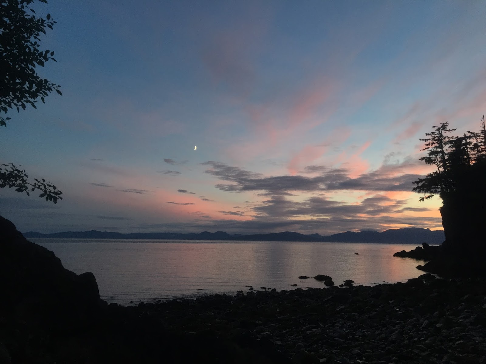
The stretch between Petersburg and Juneau is really striking, and I definitely plan to return to both the mainland side of Stephens Passage (which I paddled) and the Admiralty Island side (which I have not).  I would also like to do the connecting section between Juneau and Gustavus through Lynn Canal, Chatham Strait and Icy Strait, as well as the stretch from Juneau to Skagway up Lynn Canal, even though I have seen both stretches many times by ferry.  

By far the best paddling of the summer was the last section I paddled--my second trip, from Gustavus to Sitka.  The outer coast section is very, very beautiful--unrivaled by any other area I paddled this year.  It also has more wildlife, and wildlife of a more impressive sort, than other areas.  I have every intention of returning.      

July 30, Snettisham Peninsula to Juneau (!)


What a day!

Managed to get out of camp, in the rain, at the usual time.  Covered a fair amount of ground before about 4PM, paddling through a crowded gill net opener near beautiful Limestone Inlet, passing a bear near Point Styleman, and enjoying the beautiful scenery.  

My objective for the day was Point Bishop, at the mouth of Taku Inlet, on the West/Juneau side, and I stopped for dinner at Suicide Cove, below Butler Peak, on the East side of Taku Inlet, then headed North, to cross over.  I had initially planned to work my way several miles up the East side of the inlet before crossing, but began to get a bit of a tailwind as I headed Northwest, and decided to cut a bit of a corner and head directly for Point Bishop from Circle Point.  

Paddling in.  The light is me.
I made good time on the crossing, but it was starting to get late as I started, and a pack of gill net boats was concentrated near Point Bishop.  I normally wouldn't worry about fishing boats, but I was concerned that it would be getting dark by the time I finished the crossing, so about halfway across, I decided to head more directly towards Point Salisbury, a safer-seeming location.  It also helped that the wind was pushing me towards Salisbury! 

When I arrived, it was still light, but although I had been fairly certain that I would find a beach to camp on, I was mistaken, and it would have taken a fair bit of backtracking--towards Point Bishop--to find a nice gravel beach.  Instead of heading backwards, I figured I would continue up towards Juneau and stop (soon, I figured), when I arrived at a good camping spot.  

Very happy to be home
By this time, I was in territory that I had often paddled, and yet was surprised to find no camp-worthy beaches before DuPont, the site of a DuPont factory town from Juneau's gold mining days.  At this point, it was really getting dark--it was probably 9:00 or so--and I knew there to be good campsites above the lovely beach at DuPont, right beside the deteriorating pier which sticks out visibly into the channel there.  However, DuPont is so close to Juneau--it's a common Juneauite day hike--it felt crazy to stop there.  So I unpacked my phone and called home!  Emily sounded thrilled to hear from me, and agreed to meet me at the Sheep Creek beach/launch/zombie chum salmon colony.

The paddling was a-ok.  No wind, and almost completely calm water, with the exception of two slightly nervous moments dealing with big wakes, in the dark, from departing cruise ships.  This was only the second time I had ever paddled after dark!  It took another hour or so to paddle to Sheep Creek, but when I did, there she was, parked out on the tidal flats, ready to take me home.  It was after 10 when I arrived, and was I ever thrilled to be there.


Monday, August 14, 2017

July 29, Point Windham to Snettisham Peninsula

Another good paddling day with great mileage.  Left camp late-morning (typical start for me) and paddled most of the morning to the Southeast side of Holkham Bay, where I grabbed a snack and took a short break.  The crossing of Holkham Bay was especially beautiful, with good views up Tracy and Endicott Arms, and especially of the poetically named Sumdum Glacier.

Grabbed water and ate dinner in a cove North of Point Coke; this might be a reasonable campsite, though I did not explore extensively.  Then camped above a pretty beach on the Snettisham Peninsula, about half way between Holkham Bay and Port Snettisham, just to the Northeast of the Midway Islands.

Another solid mileage day, despite contrary currents (never did get a favorable current in Stephens Passage) and rain off and on all day.


Sunday, August 13, 2017

July 28, Point Walpole to Point Windham

From the area of Point Fanshaw (several miles before point Walpole), I had to choose between several different route options that would get me to Juneau. The Western route would be a crossing over to Admiralty Island, home of the world's highest concentration of Coastal Brown Bears, then up through beautiful Seymour Canal, across to Stephens Passage at Oliver Inlet via an old rail tram, then across to Douglas Island to Juneau. This seems to be the standard route. A second option would be to cross to Admiralty, then, rather than heading up Seymour Canal, to head up the East side of the Glass Peninsula, up the West Side of Stephens Passage, then across to Douglas Island and to Juneau. The third option, which appears to be the least commonly taken, would be to travel up the mainland side of Stephens Passage. The attraction of this route would be (potentially) more striking coastline, with views up several long, steep fjords, including Tracy and Endicott Arms and Port Snettisham.

This last option is the one I chose. All three alternatives sounded fantastic, but it seemed more likely that I would make a trip down Seymour Canal and/or the East side of Glass some time in the future. The Southern end of Stephens Passage, though, is quite a long trip com Juneau, and I wasn't sure how long it might be before I could make it back.

I was not disappointed. The scenery is unbelievable, and I was compensated for missing Admiralty bears by my earlier and later interactions with Brown Bears on Revillagigedo an Chichagoff.

In any event, the 28th was a day of crossings. Port Hougton, about four miles, Hobart Bay, about two miles, then Windham Bay, about three. The weather was again indecisive, with rain in the morning and evening an periodically through the day, but views up the three inlets were good and the scenery was very pretty. I thought the view up Windham Bay was particularly striking, and the rocky coastline was quite beautiful. Although I got little help from the flood current, the 28th was another solid mileage day.

July 27, Grand Point to Point Walpole

Another good mileage day, despite somewhat contrary tides. After a typically late start paddled down the remainder of Sumner Strait to Fanshaw Point, then turned North into Stephens Passage. Not much of note except for indecisive weather--it couldn't decide whether it wanted to rain or be sunny, making it difficult for me to decide what hat to wear and whether I wanted to wear sunglasses or not. The paddling was relatively fast, even though tides were against me most of the day and a predicted afternoon tailwind failed to materialize.

In the late afternoon, I took a break at the back of Fanshaw Bay for a snack and explored some of the site of a long-abandoned cannery; little remains, but interesting to see how quickly the forest has taken over what must have been a busy settlement forty or fifty years ago.

My preferred daily paddling rhythm is a late afternoon start, a few relatively short breaks during the day, a break during which I eat and maybe cook dinner, then a few more hours of paddling before a relatively late stop (often 8:30 or 9) to make camp. My paddling partners generally prefer a more conventional schedule, so I usually follow along; typically, a slightly earlier start and earlier finish, with dinner in camp in the evening, but paddling alone (and also with Emily, who shares my preferences), dinner on the fly is the norm. In this case, I took a short break on a gravel beach on Foot Island to eat (didn't seem like a good place to camp anyways), then paddled on to Point Walpole, on a small island, unnamed on my chart (Walpole I?) with a beautiful gravel and clamshell beach, good upland camping and a lovely view in several directions. I paddled along with a pod of feeding humpback whales for the last several miles, and they also spent the whole night feeding in the area near camp--I could hear them spouting all night long.

July 24-26, Petersburg to Grand Point

Emily's ferry didn't leave Petersburg until the evening of the 25th, so we wound up having almost three days to enjoy the amenities of Petersburg. Good to finally see the place after living so close for so long, though we probably ha a pretty good feel for Petersburg after an afternoon. But we ate lots of pizza and seafood and enjoyed our last few days together before the next stretch of my trip.

On the 25th, we carried Emily's boat and gear over to the ferry terminal in the afternoon and checked her in for the ferry ride back to Juneau. The ferry arrived on time, and we said goodbye. Sad to see her go after a great two-ish weeks together.

Got up and got packed up the following morning, and ate breakfast at the B & B. It was a little tricky to get my boat down to the water by myself, but managed to get loaded and on the water by 9:30, just a bit before low slack, so I got a little bit of a push from the ebb current out of the Wrangell Narrows into Summer Strait. I made the crossing to the North side of the strait from the Sukoi/Sockeye Islands, basically so that I would pass close to some of the icebergs I could see floating on the Northern side of the strait. I had paddled by icebergs before a number of times, but it's always a striking sight.

Spent much of the day paddling down Sumner Strait against a flood tide, but Sumner has only a weak flood current and a substantial back eddy in many places, so made good progress before stopping at an attractive campsite with good beach and upland sites near Grand Point, on the Eastern side of Farragut Bay.

July 23, Iceberg View to Petersburg

Although we originally planned to arrive in Petersburg on the 24th, having left lots of time for short days towards the end of the Ketchikan to Petersburg leg, we made such good time on the 22nd that we decided to try to make it a day early, with the idea that we would be able to spend a little bit more time exploring Petersburg and eating the legendary Petersburg pizza.

After a typical mid-morning start (late morning?) we were able to make it to Petersburg by early afternoon. At one point, close to town, we stopped for a break on a beach which would make an excellent campsite for a first or last night out, with good upland camping and a nice gravel landing beach, at least at high tide.

Once in cell range, we were able to make a phone call to out lodging, located next to the ferry terminal, and were able to add an extra night to our reservation.

The paddle into town was a trip--strong ebb tides out of Wrangell Narrows combined with lots of vessel traffic made for some high-intensity paddling. Throw in the sights and sounds of Petersburg's busy fish processing plants and the result was a little bit of culture shock after the serene wilderness paddling of many of the prior days and our mellow time in Wrangell. Cool place, though, and very true to it's Norwegian fishing town roots.

Getting in and out of town with a kayak is often a pain in the butt, but it was a little better in Petersburg than elsewhere--the ferry terminal has pretty good water access on either side of the terminal building, though we did have to carry our gear over some slippery kelp. From there, it was less than forty yards to the B and B.

The 23rd was a Sunday, and not much was open, but we were able to get some groceries and order a pizza from one of at least two local pizza joints. Studebaker's delivers, and comes with East Coast Pizza Snob Approval. Actually, both pizza places are solid options.

July 22, Wrangell through Dry Strait

Looking a little fuzzy and pretty well armed! LeConte Bay behind me.
 Dinner was macaroni and cheese.
After a tasty breakfast at the Grand View, Emily and I managed to get out on the water by about 10:30, which was about right for us to catch high slack across the Stikine River Delta, the idea being to make it through Dry Strait before the tide turned and currents made it too hard to make progress.

We had good luck on our crossing over to Mitkof, passing by Kadin island on the way. The relatively long crossing made Emily a little uncomfortable, combined with some wind and following seas, fog, and vessel traffic, but in the end, we had no problems and made it through Dry Strait just about on schedule.

In a way, the day was a little anticlimactic, since we saw no sign of gravel bars or mudflats on the delta, but we had very favorable tides all day and made good mileage. Also had some good wildlife sightings (harbor porpoises and whales). And once we were through Dry Strait, we could see icebergs floating out of LeConte bay, working their way down from the glacier.

Although the very high tides were helpful in our crossing of Dry Strait, they meant that we needed to find a good upland site--we had good luck in finding a site with a good view towards LeConte, with a nice gravel beach and water. We decided that the campsite was called "Iceberg View." The site would also have good beach camping at neap tides.

Tuesday, August 8, 2017

July 19-21, Berg Bay to Wrangell

Managed to make it through the night at Berg Bay without having our kayaks chewed on by bears, and we wanted to be out relatively early--even after our very long day on the 18th--in order to catch slack at The Narrows in Eastern Passage.  The idea was to avoid any strong contrary currents, then ride a falling tide out towards Wrangell.

We were both dragging a bit, but made good progress towards Wrangell, and anyways, weren't due to arrive there until the following day.  Mid-afternoon, made a great campsite find, located on a very small peninsula that would become an island at very high tides.  Good campsite with flat ground on either side of the cobble tombolo connecting the islet with Wrangell Island.

Eastern Passage from Wrangell Island, looking towards The Narrows and the Old Wrangell village site.

The following day, the 20th, paddled a short 7 nautical miles around the Northern tip of Wrangell I., then south past the city harbor.  Emily had reserved us a room for that night at a bed and breakfast located right on the beach, a bit south of the Wrangell Cemetery.  We were met on the beach by the owner, who very kindly helped us unload and store our boats and gave us the lay of the land.

We spent two nights there, at the Grand View, enjoying town life for a bit and seeing the sites and enjoying the mellow ambiance of the center of the world.

Monday, August 7, 2017

July 18, Frosty Bay to Berg Bay

When we started the Ketchikan to Petersburg leg, I was concerned that our planned paddle from the Frosty Bay cabin to Berg Bay would be too long--22 nautical miles, or around 26 miles--given that Emily hadn't been paddling much over the summer. But in the end, it worked out very well, with a little bit of a tidal current assist.

Riding the tide into Berg Bay
After our moderate paddle the day before, we were able to get out fairly early in the morning (early for us, that is!). We made good time to a lunch break spot in a Cove South of Point Warde (would also be a good campsite, with a clamshell beach landing and good upland camping), then paddled on, with a few short breaks. Entering Bradfield Canal, then increasing as we paddled up Blake Channel, we started feeling a strong push from the tide. We stopped for an early dinner at Blake Island, and considered stopping and camping, but it was still early and the current was moving very swiftly in our direction, so we opted to continue.

The remainder of our paddle flew by, as glassy water, which nevertheless was flowing at three knots or so, carried us North to Berg Bay, for an arrival around 8PM. The last several miles were especially beautiful, with the mountains reflecting in the aquamarine water, with hardly a ripple.

July 17, Vixen Point to Frosty Bay

The 17th seemed like a long day--both of us were dragging. We had good paddling weather and mostly favorable tides, but it was a warm day, and the previous few had been pretty tiring for both of us.

Mostly pretty rocky shorelines on the route. Hard to find good break spots without going well out of our way, which might have helped to make the day seem longer.

As we paddled past Easterly Island, we watched and listened as two male sea lions with large harems grunted at one another from several hundred yards away at one another trying to attract females away from the other.

We arrived at the Frosty Bay cabin, where we spent the night, without too much trouble. The cabin is pretty and well kept, though it was posted with reminders to campers not to store food in the cabin; apparently bears had broken into another cabin closer to Ketchikan earlier in the summer in search of food.

Wednesday, August 2, 2017

July 16, Clear Cut to Vixen Point CS

After the somewhat fraught previous days, with our complicated start on the 14th with Emily's early morning Ketchikan arrival and early afternoon departure, and the challenging weather of the previous day, the 16th was a straightforward day with solid mileage.

We got a late morning start (but earlier than previous days), and early on had another deer sighting, with four deer on the beach including two fawns. We considered stopping at Meyers Chuck, but ultimately decided just to wave as we passed, a little concerned about our schedule and anticipating long days to come.

We took a short break at "Daybreak" Cove, near Lemesurier Point, just North of Meyers Chuck. This small cove is not named on the map, but the stern of a wrecked vessel is located at the top of the gravel beach. The vessel's name, "Daybreak," is clearly visible. This cove would make for a pretty campsite at neaps, though the upland did not seem well suited to camping.

Carl would have loved this one
After turning East at Lemesurier Point, striking bare peaks East of Union Bay came into view. Our crossing of Union Bay was uneventful--about three nautical miles in around an hour. After the crossing, we stopped for dinner in a cove just South of Union Point, also filling up on water, then paddled on to a campsite near Vixen Point, several miles further to the East and North. As we neared Vixen Point, we had trouble spotting beaches for potential landing sites as the tide was quite high, but found a good with with nice upland camping a bit to the South of the point. There was some bear sign in this area--a small amount of scat on the beach and some tracks--but the scat seemed older and mostly evidence of bears just passing through; not a worry.

Finished off the day with a good view of a pretty sunset over Ernest Sound.

July 15, Caamano Point to Clearcut CS

Both a beautiful and challenging day.

We got a late start (even for me!) after our late arrival in camp the previous night. Great night's sleep, though, and we both felt much better than the day before, especially Emily, who was much better rested after a more-or-less normal night.

Had an amazing morning, with beautiful coastline and a long stretch where we paddled along with a pod of humpback whales bubble net feeding, as close as 50 yards away or less. Bubble net feeding, for you non-Alaskans, is an interesting cetacean behavior where a group of whales dive and cooperate to blow bubbles as they spiral to the surface together, driving food--fish--together where they can be easily swallowed. The bubble net behavior culminates with several whales lunging out of the water at the same time with their mouths open, then closing their mouths on (presumably) a school of fish. I've been told that this is a behavior that is only seen here in Southeast Alaska, though I don't know if that's true or not. We did our best to stay away from the whales, aware that legally we're not allowed to approach whales any closer than 100 yards, and also concerned about inadvertently winding up in a whale gullet, but several times the group surfaced near us; at moments like these, I have a difficult time estimating distance without exaggeration, but I would swear they surfaced no further than 30 yards from us at one point. Wild!


Although the weather was calm in the morning, after a lovely, sunny lunch at a pretty slot beach, we started to get a little bit of South wind in the early afternoon. The wind was never overpowering--and Southerlies were a favorable direction for us--but Clarence Straight is a body of water that runs in a North-South direction, and Southerlies can build up some relatively large waves over the length of the channel. As the afternoon went on, we started to experience waves that, though not dangerous, were enough to make Emily nervous--probably waves in the 2 to 2 and 1/2 foot range, with some reflection and refraction at different points.

After a particularly uncomfortable stretch rounding a rocky point, with complicated wave patterns, we decided to take an early dinner break in the hope that the weather would settle a bit. We made a dinner that I call Fancy Pants Mac & Cheese, ate, filtered some water, breaking for about two hours, then moved on after dinner, when the weather had settled enough to make paddling feel more comfortable for Emily.

Throughout the day, we stopped at a number of gravel beaches as we worked up the Cleveland Peninsula; good camping options in this area, with easy landings and often-accessible uplands. Water is also not in short supply.

Besides the whales, we also saw a black tail buck on the beach later in the afternoon, and passed a Black Bear, who we saw from a long way off, and who disappeared after he became aware of us.

The Northern section of the Cleveland Peninsula has been extensively logged, and as we began to near Meyers Chuck, we passed one very long clear cut strip that appeared to have been cut all about the same time, possibly as a single operation. The clear cut was a little unattractive, but a litoral buffer had been left uncut, and we found a nice campsite above the clear cut and below the beach a few miles South of Meyers Chuck. We camped on the beach, but there were small (lumpy) areas in the upland that would work as tent sites in a pinch. There was also water nearby.